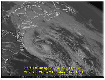
When three large weather systems collided in late October 1991 in the North Atlantic Ocean off the coasts of New England, Nova Scotia, and Newfoundland, the result was nearly apocalyptic. Coined as "The Perfect Storm" by the National Weather Service (NWS), the bizarre extratropical low might be described as the meteorological equivalent to the "Big Bang."
 The storm claimed 12 lives, including all six hands aboard the MV Andrea Gail, a commercial swordfishing boat based out of Gloucester, Massachusetts, caught out at sea 500 miles from port. Those men were the focal point of a best-selling novel, The Perfect Storm, by Sebastian Junger. Published in 1997, the novel was followed by a movie in 2000, starring George Clooney.
The real Perfect Storm
The National Oceanic and Atmospheric Administration (NOAA) and the NWS Disaster Survey Report officially called the storm "The Halloween Nor'easter of 1991." Robert Case, deputy meteorologist of the NWS Boston office, coined the phrase "The Perfect Storm" while he was being interviewed by Junger. Locals just call it the "Halloween Storm," or the "No-Name Storm."
Setting the stage
From mid-October to mid-November, New England annually undergoes swift and dramatic changes in the weather, as it transitions from Fall to Winter. Nor'easters, powerful weather systems that can span more than 1,000 miles, can occur along the eastern seaboard of the United States between October and April, when moisture and cold air are abundant. They are known for dumping huge amounts of rain and snow as far inland as the Appalachians, producing hurricane-force winds, and generating beach-eating waves and coastal flooding.
A Nor'easter is named for the direction from which the winds blow — from the northeast, on the back side of an intense weather system circulating in a counterclockwise manner. The storm is fed by the Gulf Stream current, a band of warm water that lies off the Atlantic coast.
There are two main components to a Nor'easter:
The storm claimed 12 lives, including all six hands aboard the MV Andrea Gail, a commercial swordfishing boat based out of Gloucester, Massachusetts, caught out at sea 500 miles from port. Those men were the focal point of a best-selling novel, The Perfect Storm, by Sebastian Junger. Published in 1997, the novel was followed by a movie in 2000, starring George Clooney.
The real Perfect Storm
The National Oceanic and Atmospheric Administration (NOAA) and the NWS Disaster Survey Report officially called the storm "The Halloween Nor'easter of 1991." Robert Case, deputy meteorologist of the NWS Boston office, coined the phrase "The Perfect Storm" while he was being interviewed by Junger. Locals just call it the "Halloween Storm," or the "No-Name Storm."
Setting the stage
From mid-October to mid-November, New England annually undergoes swift and dramatic changes in the weather, as it transitions from Fall to Winter. Nor'easters, powerful weather systems that can span more than 1,000 miles, can occur along the eastern seaboard of the United States between October and April, when moisture and cold air are abundant. They are known for dumping huge amounts of rain and snow as far inland as the Appalachians, producing hurricane-force winds, and generating beach-eating waves and coastal flooding.
A Nor'easter is named for the direction from which the winds blow — from the northeast, on the back side of an intense weather system circulating in a counterclockwise manner. The storm is fed by the Gulf Stream current, a band of warm water that lies off the Atlantic coast.
There are two main components to a Nor'easter:
 The storm
As usual, cold air from Canada was oozing south and combined with a cold front arriving from the west to move through the northern tier of states. At the same time, a huge high-pressure system was building over southeast Canada. That was not a totally unknown experience because it is known that land loses its summer heat faster than the ocean waters, which create ideal conditions for the development of high pressure over open waters.
The wild card was Hurricane Grace, a large tropical system that originated near Bermuda and had gained hurricane force on October 27, already causing swells of 15 feet off North Carolina's shores. Grace, which would eventually achieve the status of a Category Two hurricane, was headed in a northwesterly direction and might have made landfall along the eastern seaboard under different conditions.
This October was going to be different, to say the least.
The high pressure area off the coast of Nova Scotia and the low pressure system moving across the Northern Tier had merged into the beginnings of a typically nasty Nor'easter, swirling back on itself, once again bringing a familiar, but unwelcome storm system to the hardy folk of New England.
Hurricane Grace was in its waning stages, but still packed some high-potency winds. It made a hairpin turn northeast toward the newly combined low presure system hovering south of the Maritimes. The burst of added energy fomented seas approaching four stories high from crest to trough.
The resultant tempest in the North Atlantic claimed all things non-aquatic.
The fate of the Andrea Gail
The Andrea Gail was caught on the horns of a dilemma — it could not retreat to safer waters due to its highly perishable cargo and supposed ice machine failure — and it could not safely forge ahead. To remain as a cork in those seas was surely not an option, either.
So forge ahead they did — with predictably tragic results. They were met by 40-foot waves and winds howling at more than 50 mph. Higher waves were reported by passing ships, but they were unconfirmed.
The unnamed hurricane
As the center of the storm drifted southward over the warm waters of the Gulf Stream, the system morphed first into a tropical storm and then into a Category One hurricane. The hurricane was expected to remain out at sea, but the northeast United States was yet being hammered by the main body of the storm. To avoid confusion, NOAA decided to allow the seaward storm to become the "Unnamed Hurricane of 1991." (It would have been named Henri.)
Collateral damage
The stalled cold front in the Midwest produced blizzard conditions in eastern Minnesota, dumping 28 inches of snow on the Twin Cities and a record 37 inches on Duluth. Though the storm lasted for three days, it was fittingly dubbed the "Halloween Blizzard."
With temperatures warmer in southern Minnesota, it became a major ice storm there, snarling traffic and shutting down public transportation.
Even though the worst of the storm stayed offshore, it was estimated to have caused about $1 billion in damage. More than 1,000 homes from Maine down through the Carolinas were damaged.
Other notable Nor'easters include:
The storm
As usual, cold air from Canada was oozing south and combined with a cold front arriving from the west to move through the northern tier of states. At the same time, a huge high-pressure system was building over southeast Canada. That was not a totally unknown experience because it is known that land loses its summer heat faster than the ocean waters, which create ideal conditions for the development of high pressure over open waters.
The wild card was Hurricane Grace, a large tropical system that originated near Bermuda and had gained hurricane force on October 27, already causing swells of 15 feet off North Carolina's shores. Grace, which would eventually achieve the status of a Category Two hurricane, was headed in a northwesterly direction and might have made landfall along the eastern seaboard under different conditions.
This October was going to be different, to say the least.
The high pressure area off the coast of Nova Scotia and the low pressure system moving across the Northern Tier had merged into the beginnings of a typically nasty Nor'easter, swirling back on itself, once again bringing a familiar, but unwelcome storm system to the hardy folk of New England.
Hurricane Grace was in its waning stages, but still packed some high-potency winds. It made a hairpin turn northeast toward the newly combined low presure system hovering south of the Maritimes. The burst of added energy fomented seas approaching four stories high from crest to trough.
The resultant tempest in the North Atlantic claimed all things non-aquatic.
The fate of the Andrea Gail
The Andrea Gail was caught on the horns of a dilemma — it could not retreat to safer waters due to its highly perishable cargo and supposed ice machine failure — and it could not safely forge ahead. To remain as a cork in those seas was surely not an option, either.
So forge ahead they did — with predictably tragic results. They were met by 40-foot waves and winds howling at more than 50 mph. Higher waves were reported by passing ships, but they were unconfirmed.
The unnamed hurricane
As the center of the storm drifted southward over the warm waters of the Gulf Stream, the system morphed first into a tropical storm and then into a Category One hurricane. The hurricane was expected to remain out at sea, but the northeast United States was yet being hammered by the main body of the storm. To avoid confusion, NOAA decided to allow the seaward storm to become the "Unnamed Hurricane of 1991." (It would have been named Henri.)
Collateral damage
The stalled cold front in the Midwest produced blizzard conditions in eastern Minnesota, dumping 28 inches of snow on the Twin Cities and a record 37 inches on Duluth. Though the storm lasted for three days, it was fittingly dubbed the "Halloween Blizzard."
With temperatures warmer in southern Minnesota, it became a major ice storm there, snarling traffic and shutting down public transportation.
Even though the worst of the storm stayed offshore, it was estimated to have caused about $1 billion in damage. More than 1,000 homes from Maine down through the Carolinas were damaged.
Other notable Nor'easters include: